

iHARP Research Toolkit Portal

Interactive Applications

Explore iHARP’s scientific applications and research software to test machine learning or deep learning models and visualize geophysical predictions and complex knowledge representations.

Polaris
Active spatio-temporal time series query

Polaris

Polaris is designed based on three observations that distinguish the query workload of polar scientists, namely, all queries are spatio-temporal, not all data are equal, and the large majority of queries are aggregates. Polaris is equipped with a hierarchical spatio-temporal index structure that stores precomputed aggregates for data of interest.
Related Publications

Convolution Matrix Anomaly Detection (CMAD)
Active Antarctic sea ice Inverse max pooling Anomaly detection Clustering

Convolution Matrix Anomaly Detection (CMAD)

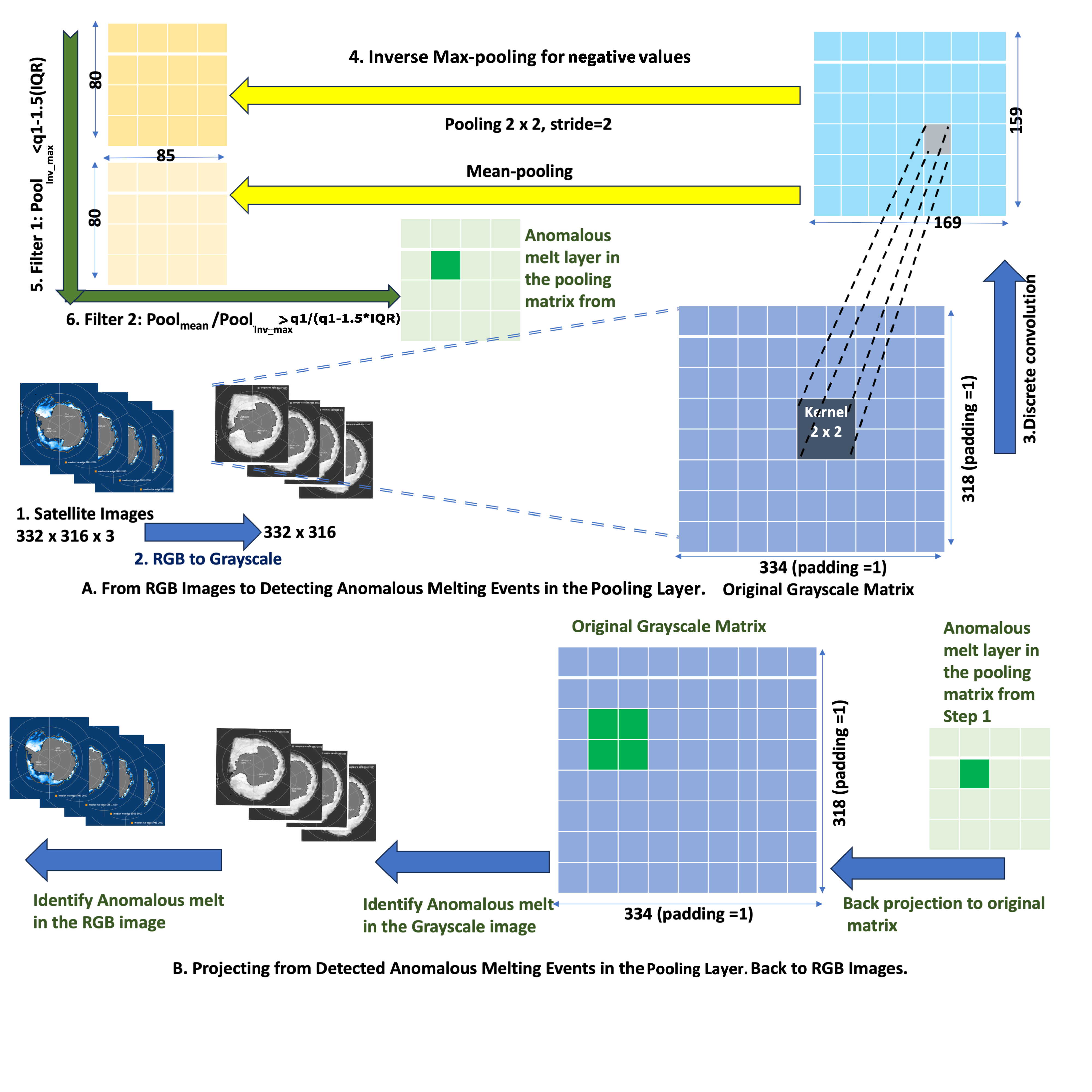
This application is an Antarctic anomalous melting detection tool. CMAD is an unsupervised anomaly detection framework designed for 2D spatio-temporal gridded datasets. It applies convolution-based matrix operations over time-series data to surface spatially coherent clusters of extreme negative events — without requiring any labeled training data.

Related Publications

Icebed Mapping
Active subglacial topography Greenland deep learning sparse radar data

Icebed Mapping

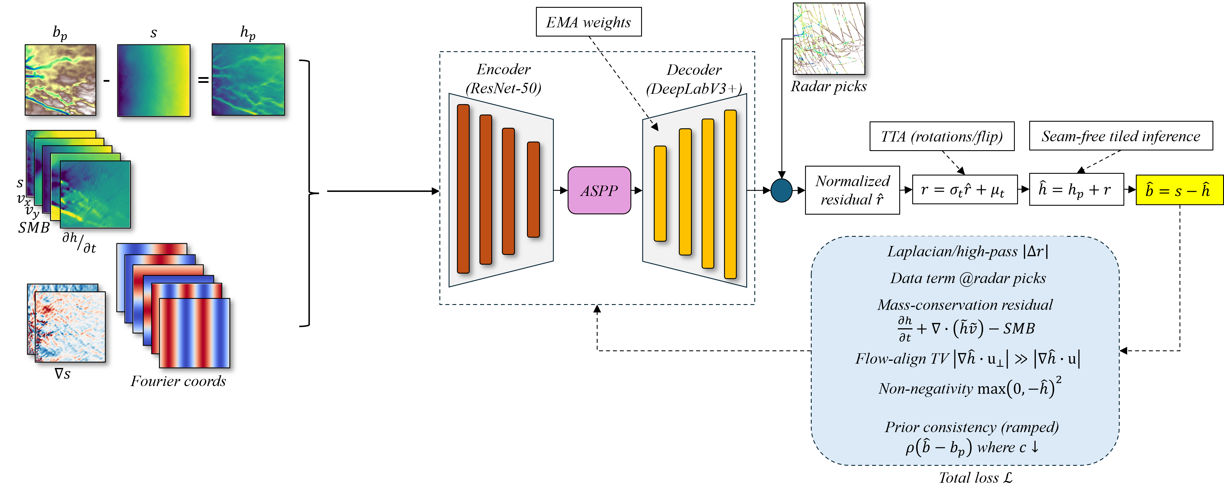
This application supports visualization of predicted subglacial bed topography beneath the Greenland Ice Sheet. The bed beneath an ice sheet strongly controls ice flow, subglacial water routing, ice dynamics, and projections of future sea-level contribution.

Related Publications

PISM: Parallel Ice Sheet Model
Active ice sheet climate science simulation

PISM: Parallel Ice Sheet Model

The Parallel Ice Sheet Model (PISM) is a computer program used in climate science to simulate the past and future of glaciers and ice sheets, including the Earth’s two large ice sheets in Greenland and Antarctica.

Ice-PatchNet
Active sea ice extent segmentation regression spatio-temporal

Ice-PatchNet

Ice-PatchNet is a novel, scalable deep learning framework designed to predict daily Sea Ice Extent (SIE) over the Antarctic region. By using a patch-based segmentation approach, the model can efficiently capture localized spatiotemporal features.

Related Publications